By Guillermo Caviasca *
Cyprus is an island of 9251 km² and in 2017 had a population of about 1.200.000 inhabitants. The history of the island dates back to the origins of mankind as it is located at a junction of communications by sea between the first civilizations of the eastern Mediterranean. Source of copper, it appears as an object of interest at least since Sargon II. The Hittites, Cretans, Achaeans and especially the Phoenicians and Greeks settled, conquered or were interested in it. Its history cannot be told even very briefly because of the large number of international political processes of which it has been part of.
But it is clear that the island is a key to what came to be called the “Middle East”: A strategic base. And in this sense it was considered and occupied by the Venetians who since the Crusades had increased their presence in the region. This occupation lasted until the Turks in 1570 expelled them after a mythical siege of the fortress of Famagusta, bringing to an end the Western European experience begun with the first crusade.
To enter the history of modern Cyprus and its current geopolitical location we must go back to an event that occurred in 1878 during the decline of the Ottoman Empire. In gratitude for the English support against Russia, the Sultan decided to cede (partially) the island to the English. That cession was transformed into a de facto colony with the defeat of the Central Empires in 1918, where the Turks had aligned with Germany.
In the second post-war period, Cyprus achieved partial independence. In the framework of the decolonization processes Great Britain agreed to a partial withdrawal (the British withdrawal was not smooth, it suffered some 300 dead in the operations of the nationalist guerrillas since the island is a key and safe post to guarantee the presence in the region and the British wanted an agreement that would guarantee the continuity of their presence). The agreements (with a certain resemblance to the Platt amendment in the Cuban case) authorized the intervention of Greek, Turkish or British forces in the event that the communities or interests of their origins were threatened. The legitimization of possible interventions is in itself a serious limit to sovereignty, to which we must add that two territories representing a non-negligible percentage of the island’s surface remained under British sovereignty and explicitly for military use.
It should be noted that the independence process of Cyprus was not a common decolonization process, since it is an island where there are two communities: the Greek majority and the Turkish, a very large minority (around 20%), with dissimilar identities and with very close ties to their “mother countries”, which in turn are very close geographically. One has to bear in mind that the Greek Cypriot community and Greece itself advocated and still advocates annexation, which is opposed by the Turkish and Turkish Cypriots. Thus we arrive at the present situation of equilibrium, the origin of which dates back to 1974 after a coup d’état in Greece and its continuation in Cyprus.
Back then began a process of annexation of the island to Greece and the Turkish reaction to it, which sent a strong military contingent to defend the minority of that origin, defeating the Greeks. The island was split in two (the Turkish Republic of Northern Cyprus). The Turkish Republic (de facto separated from the Republic of Cyprus) has a population of about 230,000 inhabitants in an area of 3,355 km². The conflict was frozen leaving an intermediate line between the two sides with a United Nations interposition force (which has a large military presence) whose logistics are supported from the British enclaves. We add that the Republic of Cyprus is a member of the British Commonwealth.
Since independence in 1960, Cyprus has had two large bases, Akrotiri and Dhekelia, which occupy 3% of Cypriot territory. They are sovereign territory of Great Britain, with about 3500 troops and a larger number of civilian personnel working for the defense (logistics, administration, intelligence) stationed here. What is the importance of these bases? As mentioned historically Cyprus is the gateway to the Middle East. Let’s look at its location: it is 480 km east of Greece (eastern coast of the island of Rhodes), 415 km north of Egypt, 130 km west of the Syrian Arab Republic, and 94 km south of Turkey. That is, from there you can monitor the Suez Canal, establish communications with Western forces deployed in the region and with Israel also about 200 km away. To project forces and logistics to any interventionist maneuver (overt or covert, military or economic) in the whole area.
Let us add to this analysis three facts. The first was the invasion of Egypt by England, France and Israel to maintain control of the Suez Canal against the nationalist policy of the Egyptian Nasser. The British troops departed from Cyprus, the British bases on the island were the logistical feasibility of the operation. But more towards the present both the interventions in Iraq and Syria have a fundamental point of support in the British bases in Cyprus, there is part of its logistics, rests the American or European fleet when it operates in the region. In fact, the surveillance and control facilities are one of the characteristics highlighted in the reports on the functions of these bases. As we can see, between Türkiye, Syria (where the Russian naval base in the Mediterranean is located), Israel, Egypt (and the Suez Canal), Cyprus is the key to the Eastern Mediterranean.
However, a new element of great importance has been added to the geopolitical equation: The discovery and commencement of the exploitation of gas and oil fields in the maritime area between Cyprus, Lebanon and Israel. In this context, the need for hydrocarbons in the West has become pressing. With the war with Russia and a future where relations between Western Europe and Russia will deteriorate for an entire historical epoch, these fundamental energy commodities take on new and renewed economic and geopolitical value. Israel has initiated a policy together with Greece and Greek Cyprus of alliance for the exploitation and export of these raw materials through a possible gas pipeline through a geographical space controlled by the West. The Israeli IR emphasizes achieving the necessary stability for these exploitations and building the appropriate alliance framework with the Greeks.
This clashes with Turkish geopolitics. That, among other aspects, is inspired by the doctrine of the Mavi vatan (Blue Homeland) that tries to expand its maritime projection breaking the partial encirclement that implies an enemy Cyprus or united to Greece. That is why the Turkish Republic of Cyprus is fundamental: It allows the opening towards the Mediterranean without passing through Greek seas, and to communicate with the areas of Libya where Turkish forces are settled, supporting the government in Tripoli. We must remember that both Türkiye and Greece are part of NATO, although at present Greece is a disciplined follower of NATO war policies, even more so after the great economic crisis that it “solved” by surrendering hand and foot to the European troika. Türkiye, on the other hand, is an uneasy partner, inherited from the Cold War. On the other hand, Greece and the Republic of Cyprus are part of the EU, while Türkiye is not. If to this we add the British strategic bases, the agreement with Israel, etc. the picture is clear.
Let’s make a comparison with another prototypical colonial situation: the Falkland Islands, South Georgia and the South Sandwich Islands. The Falkland Islands are 11 410 km². The population was estimated in 2008 to reach 3140 inhabitants of whom only 54% are defined as Malvinenses (Falcklanders). However, its population already reached 3000 people around 1900, and was in slow decline until the 1980s to less than 2000, when it recovered again to 3000 after the Falklands War with the high attention paid by the Empire to its colony. However, this population recovery (very modest as we see) was only possible thanks to the Argentine collaboration with the occupation from 1990, and the expansion of the military base. With about 1300 troops (plus as many civilians for administration, logistics, etc.), it requires a series of services. Added to this is the fishing boom permitted by Argentina in accordance with the “Madrid Declarations”. However, it is noteworthy that only a portion of the population is Malvinas and that the only notable distance of the islands with another territory is with the Argentine coast whose closest point (with the island of the States is 348 km. Malvinas remains centrally a military base, and a site of imperial geopolitical projection.
The Malvinas Islands were an unknown and uninhabited territory until the middle of the 18th century when Spain, France and the British Empire began a dispute over some islands that some navigators had located in their voyages. This dispute led to the establishment of initial settlements of a few people from these three powers, until the Spanish monarchy was recognized as sovereign of the region. From that moment on the Spanish settlement, with a commander in charge, was ruled from Buenos Aires and was maintained. It passed to the jurisdiction of the United Provinces of the Río de la Plata, which initiated projects to populate the area, until the aggression of the United States and the immediate British occupation in 1833. With the passage of time the British established a naval base and a cattle company dedicated to sheep breeding, it was a port of passage between the Atlantic and the Pacific, and a landing place for amphibian and whale hunting. This base played an important role in both world wars to defeat the German naval forces in the South Atlantic. The different Argentine governments, immersed in long civil wars and foreign aggressions, made insistent claims without interruption, until 1982, when the archipelago was recovered militarily for a short time. After the war, seven years later, the neo-liberal government agreed to normalize relations with Great Britain and this allowed the expansion of the islands’ economy.
What were and are the Malvinas geopolitically? Since its presence in the islands, the British Empire has maintained and continues to maintain a decisive projection in the control of the passage between the Atlantic and Pacific Oceans. The islands are located in front of the Strait of Magellan and immediately above the Beagle Channel and the Sickle Passage (wrongly called Drake Passage). And, this is central to the disputes of this century, the Falklands appear as the projection and gateway to Antarctica. And from there, the islands of Georgias and Sandwich are administered with which the control of the south of the South Atlantic is complete. In this sense, logistics and military presence are central. But so are the economic expansion of fishing and (not yet realized) oil.
The British military forces in the Malvinas are based in Mount Pleasant. There are four Eurofighter Typhoons, a Vickers VC-10 tanker aircraft and a C-130 Hercules, two Westland Sea King helicopters. There are also two Sikorsky S-61 civilian helicopters. Ground units include 3 signal units and a Rapier missile detachment of the Royal Artillery. The army maintains a post on the Falkland Islands in the Mount Pleasant area. This detachment consists of about 1200 personnel and is composed of infantry, as well as an engineer corps, signals/communications unit and a logistics unit. There is also a joint communications unit for electronic warfare and command and control of Navy, Army and Air Force systems.
The base has its own port, known as Mare Harbour. The Navy maintains a presence in the area with a frigate or destroyer accompanied by an auxiliary ship and a patrol vessel. Additionally, a responsible patrol vessel, the icebreaker HMS Protector, is stationed at its Antarctic base for 6 months of the year. A nuclear-powered Thipon-class submarine is stationed in the South Atlantic. In total the British forces number around 1350 troops, can be expanded with a declared capacity of up to a few thousand men and 80 fighter aircraft, but in case of emergency from England or when conducting maneuvers. Beyond the logistics provided from Chile and Uruguay due to Argentina’s erratic international policy, the British key is an air bridge through the British bases in Asención and Santa Elena. Forces that train or acclimatize for interventions in other countries usually pass through the Malvinas, in fact, currently Kosovo forces (8 men) are training in the islands. As we can see, these are not overwhelming forces, but they are far beyond the very reduced capacity of the Argentine Armed Forces for conventional warfare.
British bases in Cyprus, military situation
The sovereign base areas of Akrotiri and Dhekelia, cover 3% of the land area of Cyprus, a total of 98 square miles (47.5 in Akrotiri and 50.5 in Dhekelia). RAF 84 Squadron, logistics and intelligence units are stationed there. The military forces do not mostly own the land. About 60% is privately owned and intensively farmed. In addition to the Sovereign Base Areas themselves, the Treaty of Establishment also provides for the continued use by the British Government of certain facilities within the Republic of Cyprus, known as Retained Sites, and the use of specific training areas in the Republic of Cyprus. some 7,000 Greek Cypriots currently live on the bases. In addition, approximately 7,800 people, 3500 military and the remaining British civilian personnel work and live on the Bases.
The British have, in addition to the airfields, significant SIGINT and ELINT intelligence gathering capabilities. The Ayios Nikolaos Station This unit is a major electronic intelligence gathering station run by the British Armed Forces, some 1600 people work there and leaked intelligence sources indicate that the US is part of the operation of the station. The US has begun construction of a base of its own inside the British zone with capacity for 80 air units.
The Americans have also used the British bases as a foothold in their “anti-terrorist operations” and defense of their interests in the area. The UN supports its Peacekeeping Forces logistics from the British bases. A large Argentine contingent fraternizes and exchanges with the British during their stay, which allows those who go through this experience to acquire a certain admiration for the Western forces.
Final comparison
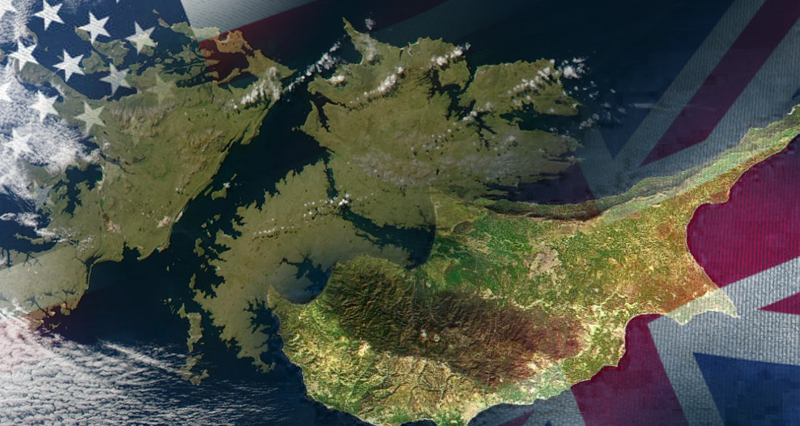
Britain currently has three forms of imperial presence on the planet. One is through the Commonwealth, its wider framework of alliances, of which the former colonies of Anglo-Saxon settlement, such as Australia, Canada and New Zealand, are particularly important. But the Republic of Cyprus is also a member of this community. The second form of British deployment is its colonies and bases over which it exercises sovereignty. They are located all over the world, particularly in the Caribbean and the South Atlantic. But also in the Indian Pacific and Mediterranean. In the Atlantic we find the Malvinas and Georgias, direct colonies of Great Britain with which it projects power in a very extensive geopolitical space. Also in this category we find Cyprus, the two British bases that are colonies, which project power and are in a geopolitical knot.
Another situation is similar: both Malvinas and Georgias, as well as the British bases in Cyprus cannot aspire to become pseudo-independent puppet states, but must be returned to their countries of origin. The difference is that Argentina is the country of origin from which these islands were taken. However, Cyprus is in a disputed situation, divided between two communities, with crossed interests of Greeks and Turks. It was never a fully sovereign “country”, and perhaps never aspired to it. A situation of difficult solution in the short term, even more so with the very prominent Israeli presence with the new hydrocarbon deposits.
Malvinas only has a history within the framework of the Spanish colony, the independent republic and the British occupation, that is, 200 years of history, and its minimal population can barely sustain itself autonomously. Cyprus has thousands of years, hundreds of thousands of inhabitants and a long and complex history of civilizations that enriched its land. However, from a political realism we can affirm that in the current situation both islands have points in common. The main one being keys to the Western colonial and imperialist presence in foreign continents, to penetrate the regions over which they project themselves with military, economic and political interests. Malvinas is located in the South Atlantic, an enormous marine territory of incalculable wealth, it is projected over Patagonia and the inter-oceanic passes, and over the Antarctic Continent, a source of wealth for the new millennium. Cyprus projects itself over the Middle East, over the Suez Canal of enormous importance, encloses Türkiye and Syria on its coasts, and is a base for communications with Israel and the projection of Western forces throughout the region. In addition, with the discoveries of gas and oil in the current context, it opens for the West a close and secure source of supply.
* Dr. in history, UBA/UNLP teacher and researcher, author of books and articles on Argentine history, military history, geopolitics and international relations.










Leave a Reply